Monday, January 21, 2008

Volcanic Heating is Melting Ice Caps


Geothermal heat is melting the ice caps.

A study published today, January 20, 2008, reveals the probable main source of the receding ice caps and climate change. The study by the British Antarctic Survey (BAS) showed the proof of a massive volcanic eruption that melted a large portion of ice shelf some 2000 years ago. The study speculates that the subterranean heating is still on going in this present day and calls for more extensive studies.

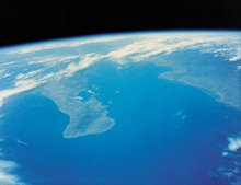
The location of the volcano is close to the Pine Island Glacier, the same area experiencing the greatest ice sheet LOSS today!!

To read a summary of the study:

Article Titled:

A recent volcanic eruption beneath the West Antarctic ice sheet

By Hugh F. J. Corr & David G. Vaughan

Published online January 20, 2008

http://www.nature.com/ngeo/journal/vaop/ncurrent/abs/ngeo106.html

This current study backs up the previous reports such as the following:

ANTARCTICA - no name volcano

June 20th, 2004

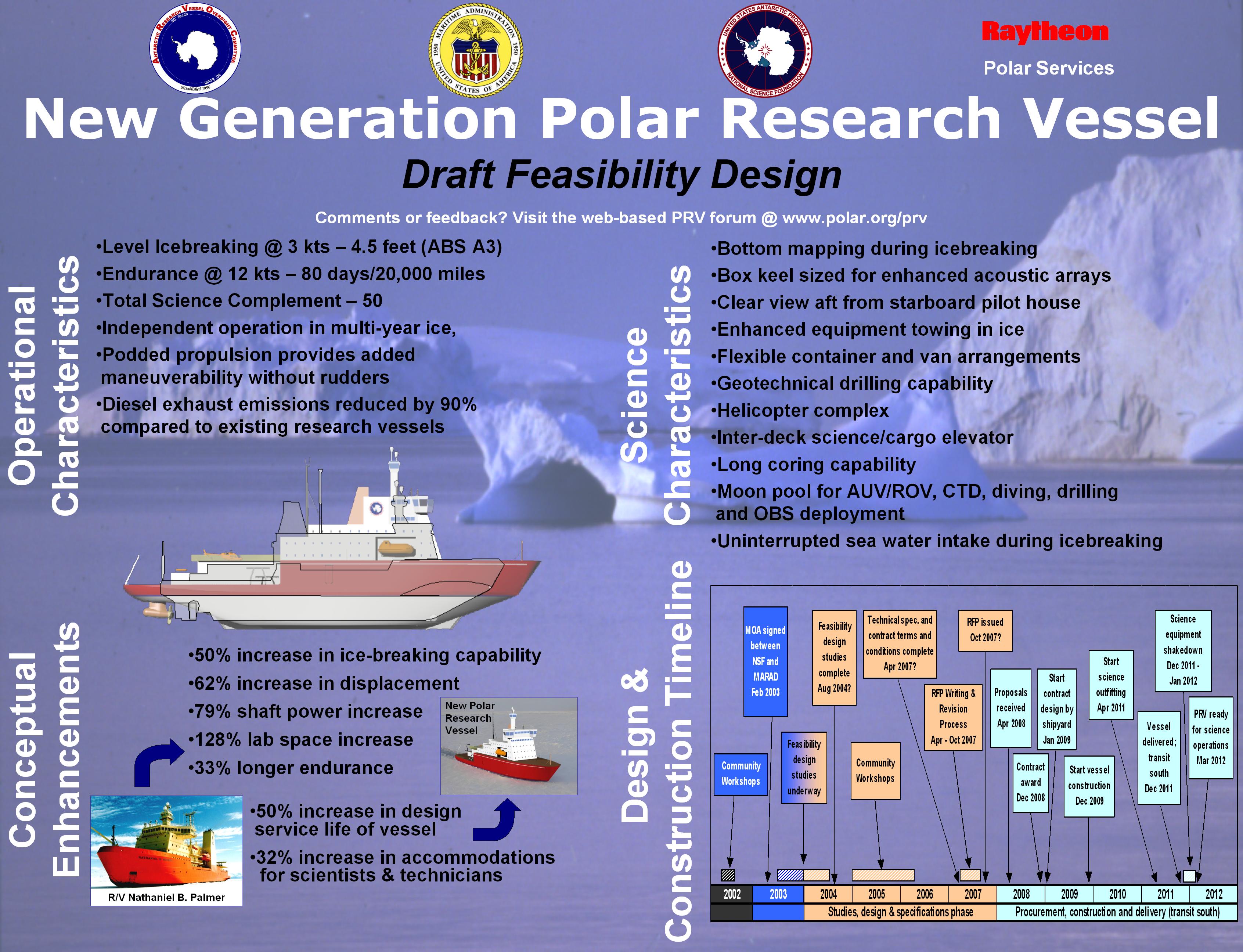
A previously unknown underwater volcano has been discovered off the coast of Antarctica, and explains mariners' historical reports of discolored water in the area. The research vessel Lawrence M. Gould (information sheet illustrating the ship ) was returning from a study of a collapsed ice self when it passed over the volcano. Temperature probes showed evidence of geothermal heating of seawater. A lack of marine life on dark rock around the volcano indicated that lava had flowed fairly recently. The volcano is in an area known as Antarctic Sound, at the northernmost tip of Antarctica. There is no previous scientific record of active volcanoes in the region where the new peak was discovered. The volcano is located on the continental shelf, in the vicinity of a deep trough carved out by glaciers passing across the sea floor. The volcano stands 2,300 feet above the sea floor and extends to within roughly 900 feet of the ocean surface.

ANTARCTICA - Erebus Volcano

June 1st, 2004

As of the 1st of June, Mt. Erebus, the southern most volcano in the world, still continues to be the most active volcano in Antarctica. Mt. Erebus (3794 meters above sea level) is classified as a polygenetic stratovolcano. The composition of the current eruptive activity on Mt. Erebus is anorthoclase-phyric tephriphonolite and phonolite, which constitute the bulk of exposed lava flow on the volcano………..

A conspicuous break in slope at approximately 3200 meters is a summit plateau representing a caldera. The summit caldera itself is filled with small volume tephriphonolite and phonolite lava flows. In the center of the of the summit caldera is a small, steep-sided cone composed primarily of decomposed lava bombs and a lag deposit of anorthoclase crystals. It is within this summit cone that the active lava lake continuously degasses (CO2) and periodically erupts. Mt. Erebus located on Ross Island, Antarctica is the world’s southern-most active volcano. Discovered in 1841 by James Ross, it is one of only a very few volcanoes in the world with a long-lived (decades or more) lava lake. Scientific research, sponsored by the U.S. National Science Foundation (NSF) since began the early 1970’s had included basic study of the petrology and geophysics of the volcano, the eruptive history, activity and degassing behavior of the lava lake, and the overall impact of the volcano on the Antarctica and global environment. Research on Mt. Erebus has been primarily conducted by scientists in the Department of Earth and Environmental Science and the Bureau of Geology and Mineral resources at the New Mexico Institute of Mining and Technology.

How inconvenient that this information has not been spread throughout the media to educate people, so that they can plan for the future.

Links:

http://www.antarctica.ac.uk/press/press_releases/press_release.php?id=341 BAS

http://www.usap.gov/vesselScienceAndOperations/images/PRVPoster-3x4.jpg Ship Information


Thursday, October 4, 2007

Balanced Scientific Inquiry


Track of Hurricane Andrew in August 1992

Controlled Media and “Global Warming”


Penn State Meteorologists Paul Knight and Fred Gadomski present a balanced, scientific, good natured discussion of Climate Change in the following video.
The opening statement in the video refers to a classic case of scare tactics being used to influence people, rather then science.

Spin Cycle: How the Media Portrays Climate Change
Date: January 21, 2006

http://video.google.com/videoplay?docid=8333874394120074576

The video is 1 hour 28 minutes in length and has over 30 minutes of audience questions at the end,starting at 60 minutes into the video.The presentation is lively and varied, with many graphs,video clips and interviews.

The questions are the type and nature that the average American (not the stupid cattle as many Elitists’ portray the average American) has on their mind.

I recommend watching it for a refreshing break from the controlled Media spin machine’s propaganda program; “Global Warming”.

Monday, July 2, 2007

Earth Sciences Practical Websites


If you have an Email or SMS capable Mobile Device, such as a Blackberry, Wireless PDA or Cell Phone, you might want to consider subscribing to all or some of the following Notification services.
If you are also in front of a computer most of the day you would want to add the Notification Services to it also,both at work and home.

To be warned when :

WC/ATWC messages are now also available via RSS.


For information on Tsunami events outside these areas, please register at ioc.unesco.org/indotsunami/subscribe_warning.htm


About Tsunami Watcher


This service provides tsunami bulletins issued from the West Coast and Alaska Tsunami Warning Center. These bulletins contain information specific to residents along the:

  • Alaska coast
  • British Columbia coast
  • Eastern Canada coast
  • U.S. West coast
  • U.S. East coast
  • Gulf of Mexico coasts.


Short format messages provided through this site are very abbreviated (messages are less than 90 characters in length). These messages are intended for dissemination to cell phones with text messaging capabilities. Due to the message length limitations, only the message type, earthquake parameter information, and a very concise evaluation is provided.

Tuesday, June 26, 2007

Hot Rocks Float Higher on Earth’s Molten Core?

In a recent article published in the the June,2007 issue of Journal of Geophysical Research-Solid Earth two scientists offer a another factor to be considered in the Climate change discussion.
Here are excerpts of the news release from the University of Utah:


  • “Scientists usually attribute the buoyancy and elevation of various continental areas to variations in the thickness and mineral composition (and thus density) of crustal rocks. But Chapman says researchers have failed to appreciate how heat makes rock in the continental crust and upper mantle expand to become less dense and more buoyant.


  • "We found a good explanation for the elevation of continents," Hasterok says. "We now know why some areas are higher or lower than others. It's not just what the rocks are made of; it's also how hot they are."


In effect the two scientists,Derrick Hasterok and David Chapman of the University of Utah,say that their theory is:


that Rock structure that is warmer than other similar rock masses, is less dense and will rise up higher in elevation above the Earth's molten core.


The dynamic between molten rock under water and rock in the atmosphere is mentioned in the study.


Just like sticking your finger into the crust of a Hot Cherry pie, first depresses the surface, and then breaks through, causing the hot contents to spill out over the pie crust surface ,so it is with the earth’s mantle and molten core.


The News release about the study gives an additional perspective to the discussion of global warming and cooling by describing the process where molten lava flowing onto the seabeds around the earth cools, becomes more dense and pushes the mantle down into the molten (liquid) core.This causes uplift of the Warmer more bouyant Rock above sea level that is exposed to the Atmosphere.


The stresses caused in the Earth’s mantle, from a LAVA Lamp type dynamic plays an important part in understanding climate change. If you have ever watched a LAVA Lamp for any extended period of time you will observe the globules rise and then cool and descend back down to the lamp in the base of the Lamp in an endless cycle, at least while the power is on to the lamp.

The Earth’s molten core has a similar circulation pattern.

THINK: Where in the rise and fall ,Heating and Cooling Cycle ,of the Earth’s Molten Core, are we right Now?


Ice Ages happened without man’s intervention and so have warming periods.


How else would anyone explain the following:


· Ferns and Breadfruit fossils in Greenland
· Continents shifting
· Periods of Volcanic Eruptions
· Submergence of Ancient Cites that at one time where above sea level.


Today you can Scuba Dive over a complete city in 30 feet of water,located miles from the existing coast of present day Egypt .A city that was above WATER within the Last 2,200 years.


According to some of todays "scientists" ,some one must of ran their SUV too long 2,200 years ago!